Gerenciador de mídias
Espaços de nomes
Selecione o espaço de nomes
Arquivos de mídia
Arquivos em cienciaaberta

- 5-flyer.png
- 723×511
- 2016/04/05 22:32
- 198.8 KB

- addlayerslink1.png
- 146×140
- 2016/10/17 14:39
- 3.3 KB

- addlayersselect_quickstart.png
- 323×506
- 2016/10/17 14:41
- 27.4 KB
- ap_datageo_ws_ubatuba_v2.pdf
- 2016/06/05 11:02
- 745.9 KB
- apresentacao_bdg_otss_concepcao_inicial.pdf
- 2016/06/05 11:07
- 437.7 KB
- apresentacao_dados_bdg_zee_-_sem_imagens.pdf
- 2016/06/05 11:02
- 546.9 KB

- capa_post.jpg
- 512×338
- 2016/06/21 10:29
- 172.4 KB

- captura_de_tela_de_2016-08-16_10-33-31.png
- 1666×849
- 2016/08/16 10:37
- 346.3 KB

- conversa_dados.gif
- 640×480
- 2016/03/18 20:18
- 541.7 KB

- createmap1.png
- 2868×1378
- 2016/10/17 14:34
- 3.4 MB
- dadosgeoespaciaiscbh-ln_20maio2016.pdf
- 2016/06/05 10:58
- 1.8 MB

- dsc_0028.jpg
- 3264×2448
- 2016/08/08 23:11
- 2 MB

- dsc_0034.jpg
- 960×720
- 2016/08/08 22:35
- 494.2 KB

- dsc_0036.jpg
- 960×720
- 2016/08/08 22:35
- 453 KB

- dsc_0038.jpg
- 960×720
- 2016/08/08 22:35
- 474.2 KB

- dscf2272-1.jpg
- 800×600
- 2016/04/16 11:32
- 312.9 KB

- files_to_be_uploaded.png
- 1522×850
- 2016/10/17 14:20
- 91.6 KB

- flyer-web.png
- 813×633
- 2017/03/07 15:09
- 110.6 KB

- geonode_component_architecture.png
- 1144×958
- 2016/10/17 15:06
- 219 KB

- img_9718.jpg
- 900×600
- 2016/06/10 10:23
- 84.2 KB

- img_9754.jpg
- 900×600
- 2016/06/10 10:23
- 68.4 KB

- img_9773-crop.jpg
- 842×243
- 2016/06/21 10:29
- 78.1 KB

- img_9773.jpg
- 900×600
- 2016/06/10 10:23
- 107.5 KB

- img_9784.jpg
- 900×600
- 2016/06/10 10:23
- 104.1 KB

- img_9790.jpg
- 900×600
- 2016/06/10 10:23
- 71.3 KB

- img_9793.jpg
- 900×600
- 2016/06/10 10:23
- 98.5 KB

- img_9794.jpg
- 900×600
- 2016/06/10 10:23
- 85.1 KB

- img_9798.jpg
- 900×600
- 2016/06/10 10:23
- 82.6 KB

- img_9803.jpg
- 900×600
- 2016/06/10 10:23
- 87.8 KB

- img_9804.jpg
- 900×600
- 2016/06/10 10:23
- 74.9 KB

- img_20160318_162207-edit.jpg
- 1024×455
- 2016/03/18 21:56
- 133.7 KB

- img_20160803_164025586.jpg
- 1000×400
- 2016/08/16 11:01
- 373.9 KB

- img_20160808_151536849.jpg
- 4160×2340
- 2016/08/08 23:10
- 2.1 MB

- img_20160808_162631656.jpg
- 4160×2340
- 2016/08/08 23:11
- 2.4 MB

- img_20160808_162646134.jpg
- 2340×4160
- 2016/08/08 23:11
- 2.2 MB

- layerstoolbar_quickstart.png
- 1170×144
- 2016/10/17 14:13
- 14 KB

- logo-seminario.png
- 600×119
- 2017/03/03 16:58
- 21.8 KB

- logo.png
- 300×300
- 2015/12/07 22:36
- 15 KB

- logos-rodape.png
- 855×81
- 2017/03/03 17:09
- 38.7 KB

- mapname1.png
- 155×56
- 2016/10/17 14:45
- 1.5 KB

- maps_quickstart.png
- 1274×656
- 2016/10/17 14:33
- 51.9 KB

- oficina_qgis_1.gif
- 640×480
- 2016/03/18 20:18
- 311.2 KB

- oficina_qgis_2.gif
- 640×480
- 2016/03/18 20:18
- 269.7 KB

- peripatosaopaulo-1024x622.png
- 1024×622
- 2016/04/05 22:15
- 194.1 KB

- permission.png
- 377×616
- 2016/10/17 14:27
- 36.4 KB

- publishmap1.png
- 412×246
- 2016/10/17 15:01
- 17.5 KB

- publishmaplink1.png
- 153×117
- 2016/10/17 15:00
- 3.7 KB

- rios_sampa.gif
- 629×480
- 2016/04/13 11:48
- 454 KB

- savemapdialog1.png
- 424×391
- 2016/10/17 14:44
- 12.8 KB

- savemaplink1.png
- 130×101
- 2016/10/17 14:44
- 3.3 KB
- terra_agua_gente.pdf
- 2016/03/09 10:44
- 560.9 KB

- toolbar_quickstart.png
- 1298×63
- 2016/10/17 14:09
- 12.7 KB
- ubatubamai2016.pdf
- 2016/06/05 11:06
- 3.4 MB

- uploadform_new_quickstart.png
- 1170×588
- 2016/10/17 14:15
- 57.1 KB

- wkshgeo.gif
- 640×360
- 2016/06/09 21:25
- 5.4 MB
- workshop_gis.pdf
- 2016/07/02 11:20
- 2.3 MB
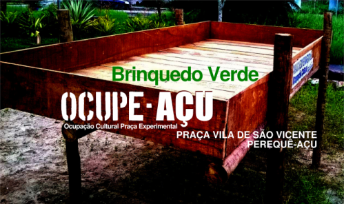
Arquivo
- Ver
- Histórico
- Data:
- 2016/04/03 19:58
- Nome do arquivo:
- flyer-brinquedo.png
- Formato:
- PNG
- Tamanho:
- 526KB
- Largura:
- 667
- Altura:
- 396
- Referências para:
- brinquedoverde


